Map of Where We Have Been
It seems most of you reading have not been able to put into context where we have been traveling. Here are three maps to help you out. I think you can double click the map and it will open a larger view of it.

Route continued via Alaska Marine Highway Ferry: Haines - Juneau - Petersburg - Wrangell - Ketchikan - Prince Rupert, BC

 Hope this helps!
We started in Fairbanks and went the following route: Fairbanks - Coldfoot - Prudhoe Bay - Fairbanks - Circle - Fairbanks - Delta Junction - Paxon - Talkeetna - Anchorage - Homer - Seward - Whitter- Anchorage - Glenn Allen - Valdez - Kennicott - Glenn Allen - Tok - Chicken- Eagle - Boundary - Dawson City - Carmacks - Whitehorse - Haines Junction - Haines
Map of Alaska

Route continued via Alaska Marine Highway Ferry: Haines - Juneau - Petersburg - Wrangell - Ketchikan - Prince Rupert, BC
Map of Southeast Alaska

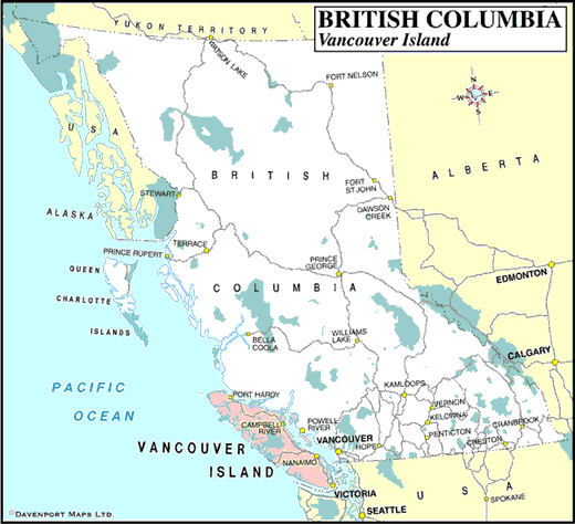
We got off the ferry at Prince Rupert and are heading east toward Edmonton. We are currently 120 miles west of Terrace. We will go towards Prince George first, then drop down to Jasper(that is the big green area on the border with Alberta) and then head back northeast to Edmonton.
British Columbia Map
 Hope this helps!
posted by dave and jody at
1:46 PM
![]()

0 Comments:
Post a Comment
<< Home