When we got off the ferry in Prince Rupert, British Columbia we started making big pushes east towards the Rocky Mountains and the sun. Here are some of the notable events from this portion of our journey:
9-13-06: Peak Oil
We had a chance encounter with a fellow dog owner while eating lunch at a highway rest area. Nate is getting his PhD in Vermont studying Peak Oil. In simple terms Peak Oil revolves around the idea that worldwide oil production is decreasing while oil consumption is exponentially increasing. While the concept seems simple, the implications are far from it. How long we will be able to maintain this precarious situation is up for debate. Most experts agree within 25 years drastic changes will have needed to occur or the American way of life will no longer be attainable.
America in particular has developed a way of life that revolves around petroleum based products. Goods are either transported long distances or use oil to produce. While America is leading this trend, other developing countries are quickly falling in our shoes, creating a nonsustainable situation that will only get worse as petroleum becomes tougher to find and afford.
To understand how Peak Oil could affect your life, try answering the following questions:
- How far do you drive to your place of business? Is it possible to get there without a motor vehicle? Is it economical to get there if gas is $6/gallon?
- How is your home heated/cooled? How long could you continue to pay your heating/cooling bill if it doubled? Tripled?
- How far is your grocery store? Does it sell locally grown goods? (When gas prices skyrocket food that is shipped long distances may no longer be affordable.)
Tough questions. But the fact of the matter is Peak Oil is a situation we can be prepared for. By making a few basic changes to our lifestyles, we can drastically alter the worst case scenario of economic collapse. We need to be aware that our simple, everyday choices have far reaching effects. To do your part, try implementing some of the following items into your daily schedules (we are doing our best to follow these as well):
- Consume less. This is the easiest way to live more sustainably. Ask yourself if what you are buying is really needed. What did people do before that item was available?
- Next time you make a purchase find out where it was made. Try not to purchase items that were shipped long distances, especially overseas.
- Buy locally whenever possible, especially food. Farmers markets are good places to start. Stop shopping at the big box stores. Buy from the Mom and Pop instead.
- If your local grocery store is NOT carrying locally produced goods find out why. If more people start requesting them management may start carrying them.
- Plant a garden and grow your own food.
- Use compact fluorescent light bulbs. They cost a little more up front but they are far more efficient and last much longer.
- Be conscience of where you set your thermostat. Try opening windows if you are hot or wear more layers if you are cold.
- Drive less. Ride a bike or walk instead. Not only will Mother Nature thank you but your heart will too.
- Car pool to work.
- If you must have a vehicle, buy one that is the most fuel efficient. Try to limit your household to one vehicle.
- Use the sun to dry your clothes instead of a dryer. Don’t wash your clothes after you wear them once. Wait till they really need to be washed.
- If you are in an area where wind and solar are available, incorporate them into your house. There is loads of information of how to get started in the internet.
- Turn off your lights when they aren’t needed. (I am in awe of how many people leave lights on all day long without every stepping foot into that room. Why?)
- Turn off the faucet when you are brushing your teeth or shaving.
- Wash your dishes by hand and skip the dishwasher. Even efficient dishwashers use a lot of energy to run.
- Use a manual lawn mower to mow your yard. They don’t use any petroleum products!!
- Collect rain water to water your garden and plants.
- Get involved with local politics. It is possible to see sustainable progress if a core group of dedicated people are working for changes and educating others.
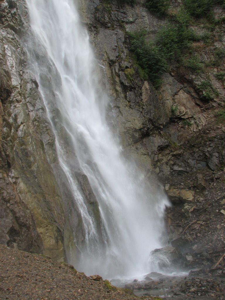
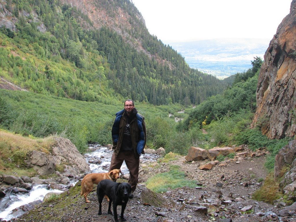
9-14-06: Smithers, British Columbia
We spent a couple of days camped near a couple of neat waterfalls in Smithers. The fall colors were out in their glory and while the trail got quite a bit of use, we had it to ourselves when we finally hiked it. (This is definitely one of the perks of traveling after the tourist season.) It started getting chilly at night with subfreezing temperatures but the days would warm up into the 50’s and the sun was out.
Waterfall

Dave and the Dogs Watching the Waterfall and the Fall Colors
We awoke to an interesting noise one night. It sounded as if something was chewing on the underside of the van. We could not figure out what it was even after we looked out the windows and got out with the flashlight. There was no evidence of it in the morning. Was it a squirrel? A porcupine? Sasquatch?
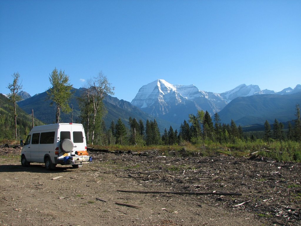
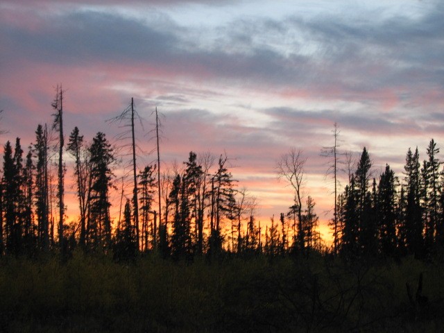
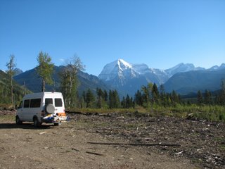
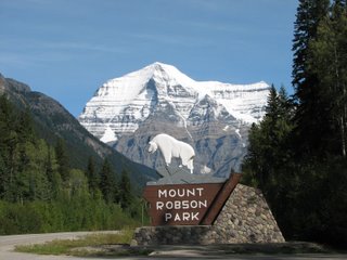
9-16-06: Mount Robson Provincial Park
At 12,972 feet Mount Robson is not only an impressive mountain; it is the tallest mountain in the Canadian Rockies. (The US Rockies have numerous 14,000 feet mountains, mostly in Colorado.) It was established in 1913 and is the second oldest park in British Columbia. Together with the other parks to the east and south it comprises one of the world’s largest protected areas.
We found an old logging road with a large clearing and ample amounts of campfire wood. We split enough dry wood to last us for days. After weeks of rain and damp or wet wood it was fun to split some truly dry wood. We had a great fire and watched the stars. It was the first time on the trip that it was dark enough and clear enough for the whole sky to be filled. It looked as though you could touch Orion’s belt. As if that were not enough, when we awoke and looked out the ‘bedroom’ window Mount Robson was lit up in sunlight. Not a cloud in the sky. This was a great way to start the day.
Bedroom Window Site
Entrance to Mount Robson Provincial Park
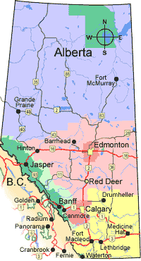
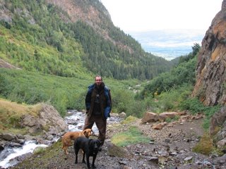
9-17-06: Jasper and Banff National Parks
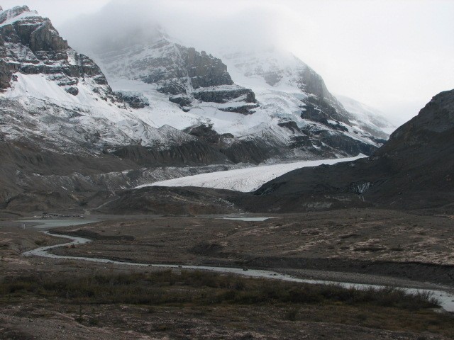
From Mount Robson we headed next door to Jasper National Park in Alberta. We soaked in the Miette Hot Spring (the hottest springs in the Canadian Rockies), took in Athabascan Falls (a 75-foot waterfall that creates one of the most powerful flows to be found anywhere in the mountain parks), and went for a walk on Athabascan Glacier. (We did this same trip in reverse in 2002 on our way to Alaska.)
Athabascan Falls

Athabascan Glacier

The National Parks were beautiful but also very expensive to visit.
$18 – Daily Entrance Fee
$19 – Camping Fee (You were only allowed to camp in designated spaces yet most of the campground were closed.)
$7 – Campfire Permit (You need to pay this fee just to have a fire, regardless if you brought your own wood.)
This equaled $44 to camp and have a fire in the National Park for one night.
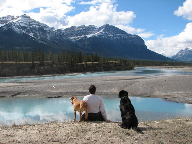
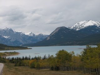
It wasn’t economical for us to stay too long in the National Parks when the surrounding Provincial Parks and Reserves were free. We drove outside the park boundaries at night and found great, free, legal camping. (One night we camped in a foot of wet snow. This was a fluke occurrence that snapped many of the younger trees that still had their leaves.) We are getting spoiled with private, scenic camping spots. It will be tough when we get to places where you can hear others nearby or have to tie the dogs up.
Alberta Scenery
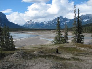
We are skirting the southern portion of Banff National Park to head northeast to Edmonton. We camped alone in a Forest Reserve. Here we were 10 miles away from Banff National Park where it cost $44 to camp and we were seeing just as beautiful scenery; we were paying nothing and had the place all to ourselves. Makes you wonder why more people weren’t doing the same.
River Valley Near Campspot in
Forest Reserve

9-20-06: Edmonton, Alberta
From our isolated camp spot in the Canadian Rockies we rolled into Edmonton, Alberta (one of the biggest cities in Canada). We jumped right into city driving mode, with some coxing, and went to see some live DIY (Do It Yourself) music downtown. Two bands played – it was loud, fast and obnoxious but exactly what we were looking for. With ears bleeding and blood pumping we went to the nearest Wal-Mart to sleep as they allow free RV camping in their parking lots. This is one of the only good things we have to say about Wal-Mart. In a big city it is hard to find safe van camping. The parks normally close at night. There are no forest roads. And anywhere else, except for the ghetto, the police tell you to keep moving. Who would have thought that Wal-Mart would be the ray of light in this situation?
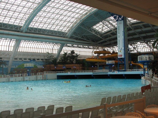
Edmonton is home to the world’s largest shopping mall. Over 800 stores, 100 eateries, three theme parks and 26 movie theatres, including an IMAX, make up over 5 acres. We decided we had to go and witness consumption at its finest hour. Let’s just say that we were not let down. The real reason to visit this monstrosity was its water park. Those of you who know my sister and me, know we can’t pass up a good water park. Although the huge wave pool and over 12 waterslides looked enticing we were unable to afford the $30/person entrance fee. I was bummed but there was more than the water park to keep our attention. In addition to the water park, the West Edmonton Mall had an NHL sized ice skating rink, a replica of Christopher Columbus’ ship the Santa Maria, a sea lion show, an aquarium and hordes of people. We didn’t stay long.
Water Park at the West Edmonton Mall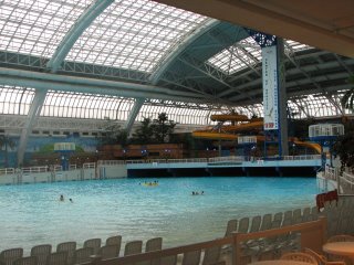 Replica of Christopher Columbus’ Ship the Santa Maria

While in Edmonton we saw hockey legend Wayne Gretzky. We got our photo taken with him and commented on how sore his shoulders must be from hoisting the cup all these years.

Before we jetted we took in the sights of Old Strathcona, a historic district on the eastern side of town. It had an eclectic mix of people and shops, even all the electrical boxes were painted with funny murals to liven up their appearance.
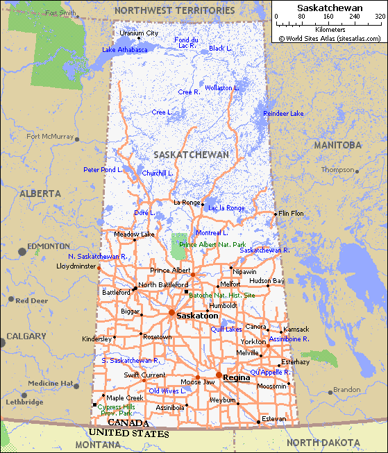
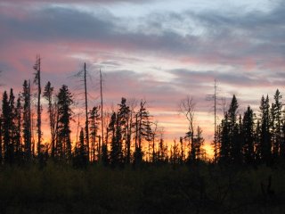
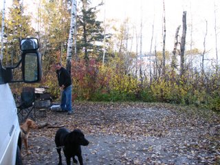
9-23-06: Saskatchewan
From Edmonton we traveled northeast toward Prince Albert National Park. Judging from the literature we read and the people we talked to in the town of Prince Albert it sounded worth the trip even with the high costs of national parks. This was a rather strange park because there is a town smack dab in the middle of the park. Waskesiu is home to many summer cabins, a golf course and other amenities Americans are used to seeing outside a National Park’s borders. Most of the community was closed down but we were able to take advantage of the campground’s showers and loaded back up with water.
Sunset at our Camping Spot in Prince Albert National Park
 While driving on the park’s roads we had a VERY unusual wildlife encounter. We spotted a cougar in the middle of the road. It quickly moved away so we were unable to get a photo but we were left in awe of such a sight. We talked with the rangers about it and they told us it is extremely rare to see one in the park, especially on the road. It was larger than Sprout, had thicker legs and feet than a wolf, and had an extremely long tail.
Sunset at Our Camp Spot on a Logging Road in Saskatchewan
9-25-06: Manitoba
Manitoba looks much like the plains of the U.S. It is very flat with numerous large farms. We visited Riding Mountain National Park. It is essentially an island of forest surrounded by farms. The park staff were working closely with the surrounding farm owners to ensure the wildlife that left the park’s borders had a safe place to go. There were signs all over about managing on an ecosystem scale approach that left the farmers with a valuable role.
Riding Mountain National Park Campsite
 The fall colors were out and when it rained it moved through rather quickly giving way to partly sunny skies. We didn’t stay in the park too long but we did climb one of the lookout towers to get a better view of the surrounding area and take in the fall colors from a different angle.
Dave and the Pooches on the Lookout Tower

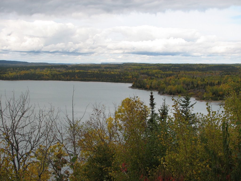
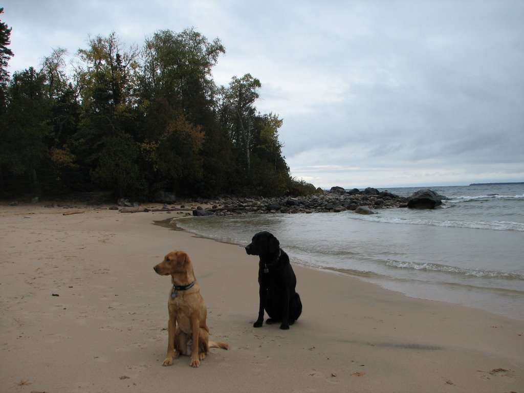
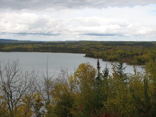
9-28-06: Ontario
Ontario sits on the northern shore of Lake Superior and looks very similar to the Upper Peninsula of Michigan (on Lake Superior’s southern shores). I guess you could define the landscape as Canadian Shield (boreal forest with lots of rocky outcroppings). There was water everywhere, along with lots of little forested islands. There were numerous national and provincial parks along the lake shore and LOTS of trails to explore further off the road system.
Scenery Along Northern Lake Superior
Rocky Outcropping

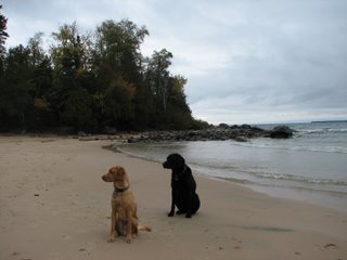
First Time the Dogs Saw Lake Superior
One stunning feature of Ontario is a waterfall called the Niagara of the North. This monstrous waterfall has a place in local legends and can be heard from miles away.

Fishermen near
Chippewa Falls
 We were both looking forward to spending some time in northern Ontario. Yet when we finally got there the weather was getting chiller and the cost of traveling in Canada was starting to take a toll on our budget. As a result we weren’t able to devote as much time as we wanted in this area and decided to save it for another traveling period. So with Michigan on the mind we hurried along Lake Superior and started the drive back to our home state.
.jpg)
.jpg)
.jpg)
.jpg)
.jpg)
.jpg)
.jpg)
.jpg)
.jpg)
.jpg)
.jpg)
.jpg)
.jpg)
.jpg)
.jpg)
.jpg)
.jpg)
.jpg)
.jpg)
.jpg)
.jpg)
.jpg)
.jpg)
.jpg)
.jpg)